

Topographical Surveys vs Off-the-Shelf Data: 2026 Insights
The Commercial Risk of Generic Land Mapping
Summary Overview
If you are starting a new project that requires land surveying and asking yourself, “do I need a topographical survey, or is standard off-the-shelf data enough?”, the choice you make is crucial.
- Topographical surveys provide precise data essential for accurate engineering design.
- Using off-the-shelf land mapping can lead to costly errors and project delays.
In this blog article, we will discuss the critical risks associated with relying on pre-packaged data. We’ll also highlight the advantages of commissioning a detailed topographical land survey for your infrastructure projects.

Using readily available data in the feasibility and design phases of an infrastructure project poses a significant commercial risk.
Planners and project managers frequently try to lower initial costs by buying generic digital terrain models or commercial LiDAR datasets from online providers. This strategy almost always leads to expensive rework on-site.
To establish a dependable design baseline, project teams must commission a new topographical survey before progressing beyond the conceptual stage.
The physical world is always changing. Using generic spatial data to design a modern asset creates unacceptable business risks.
The False Economy of Pre-Packaged Data
Legacy data is no longer limited to historical paper maps. Today, the trap is off-the-shelf spatial information. This includes commercial aerial products, generic GIS packages, and pre-packaged LiDAR data from online vendors.
The fundamental flaw in using this data for land mapping is the terrain delta. The physical site changes while the digital file remains frozen in time. If a civil engineer designs a multimillion-euro infrastructure asset based on a generic dataset, the digital model will inevitably clash with the physical reality of the site.
Common examples of dangerous off-the-shelf data include:
- Generic Digital Terrain Models: Online vendors provide broad-scale elevations that lack the strict vertical tolerances (+10mm) required for detailed engineering design.
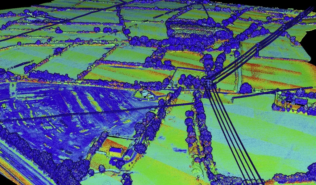
- Commercial Aerial LiDAR: Broad aerial sweeps offer general context but frequently miss critical ground-level assets obscured by vegetation or existing infrastructure.
- Outdated “As-Built” Drawings: Modifications made by contractors post-construction are frequently missing from final handover files.
The Liability of Designing on Unverified Land Surveys
When an engineering team accepts unverified, off-the-shelf data, they absorb the associated financial risk. A modern topographic survey maps the precise surface geometry and coordinate systems required for accurate engineering outputs.
Consider the commercial impact on earthworks and volume calculations. A vertical error of just 50mm across a 10-hectare site equates to 5,000 cubic metres of miscalculated earth. This discrepancy leads to immediate budget overruns when the contractor breaks ground and discovers they need to export thousands of tonnes of material they had not priced for.
Furthermore, while generic GIS maps may indicate historical boundaries, they lack the strict accuracy required for detailed design purposes. A dedicated land survey eliminates this guesswork and provides a verified, liability-free foundation.
Real-World Proof: The Barnesmore Gap Corridor
The commercial risk of off-the-shelf data scales directly with the size of the project. For the Barnesmore Gap Greenway project, iO Geomatics was tasked with a comprehensive topographical land survey along a 30 km corridor.
The route traversed a diverse landscape, including agricultural land, urban areas, forestry, and complex road infrastructure. Relying on pre-packaged aerial products for a route of this scale would have introduced massive design risks. To eliminate this risk, a hybrid survey methodology was deployed to ensure efficiency, accuracy, and full corridor coverage.
We integrated three specific land surveying technologies to capture verified data:
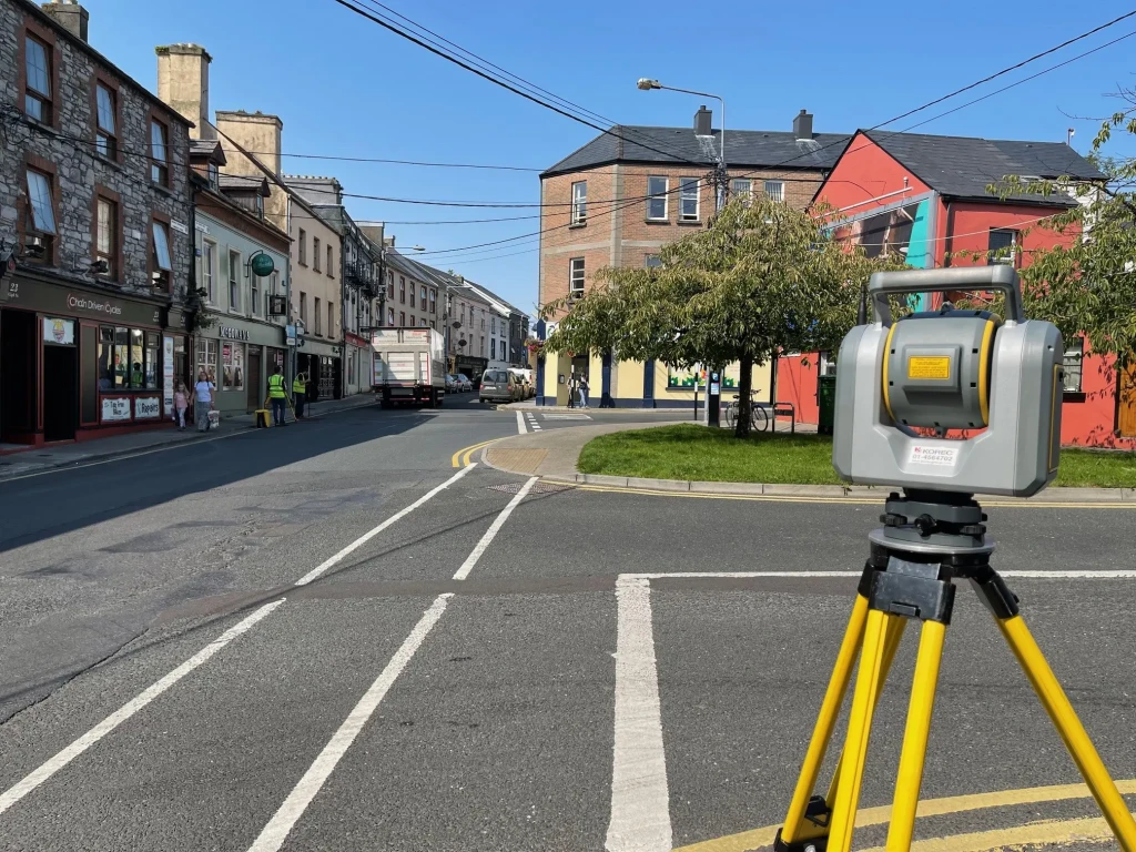
- Mobile Mapping: All public roads within the corridor were surveyed using mobile mapping technology to capture road geometry rapidly.
- Conventional GNSS: Off-road areas were surveyed using conventional GNSS and total station methods to capture terrain and boundaries.
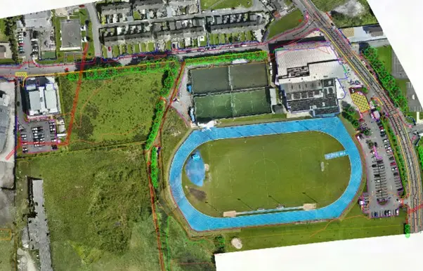
- UAV Survey: A full-length UAV survey produced a high-resolution orthophotomosaic of the entire route.
This hybrid approach provided a continuous and consistent spatial dataset across the entire 30 km corridor. It formed a verified baseline for greenway design and planning that generic data could never achieve.
Secure Your Design Baseline
Data integrity is non-negotiable. Attempting to save a fraction of the budget by purchasing cheap topographical surveys online routinely costs ten times that amount in site delays and design revisions.
Project managers must define their required vertical tolerances and deliverable formats before issuing a tender. Discard assumptions, reject off-the-shelf data files, and specify a verified spatial baseline.
Eliminate design risk before construction begins.
Contact iO Geomatics to discuss your project-specific tolerances and commission a verified topographical survey.
Start Your Project with a Verified Survey Today!
Topographical Survey FAQs
What is the “terrain delta,” and why does it matter for design?
The terrain delta is the gap between the ever-changing physical site and frozen-in-time digital files. Because land conditions shift, the earth settles, vegetation grows, utilities are added, and drainage patterns evolve. Designs based on off-the-shelf data will eventually clash with reality. This mismatch drives rework, delays, and cost overruns once construction begins.
Why is designing on generic digital terrain models a commercial risk?
Accepting unverified generic data transfers financial risk directly to the design team. Even small vertical errors scale dramatically. A 50 mm error across 10 hectares miscalculates roughly 5,000 m³ of earth, leading to unplanned export/import costs and budget shocks. Online LiDAR products are excellent for general context but lack the tight vertical tolerances needed for engineering design and BIM alignment.
What does a vertical tolerance of +10 mm mean, and why won’t off-the-shelf products suffice?
A +10 mm vertical tolerance sets the maximum allowable elevation error for datasets feeding detailed engineering. This includes earthworks, drainage, clearances, and BIM coordination. Pre-packaged GIS products are not produced to this accuracy. Using lower accuracy data invites cumulative errors that become costly on site.
When should I commission new topographic surveys, and what should I specify?
Commission a new survey before moving beyond the conceptual phase. This is especially true if you are considering using generic online data or if the site has undergone alterations. In your tender, define the required vertical tolerances and deliverable formats. Reject off-the-shelf CAD files and require a verified spatial baseline tied to the correct coordinate system.
What is the difference between a Topographical Survey and a Boundary Survey?
A topographical survey focuses on capturing the precise three-dimensional geometry of a site for engineering and design purposes. This includes its contours, elevations, and natural or man-made structures. A boundary survey is strictly concerned with determining the legal boundaries of a property and establishing easements for ownership purposes.
Why use a hybrid survey methodology like the Barnesmore Gap example?
Over long or complex corridors, no single method captures everything efficiently and accurately. Combining technologies ensures complete, consistent coverage. This includes mobile mapping for rapid road geometry, conventional GNSS for off-road terrain, and UAV surveys for high-resolution imagery. This integrated dataset forms a verified baseline that de-risks planning across diverse environments.


