

Choosing the Right Aerial Methodology for Your Topographic Survey
Summary Overview:
- Choosing the Right Methodology: Different aerial survey methods, including point cloud photogrammetry, UAV LiDAR, and analytical stereo photogrammetry, are suited for various terrain conditions and project requirements, each with its own advantages and limitations.
- Importance of Expertise: A successful topographical survey relies on the experience and judgement of skilled surveyors who can interpret complex terrain and ensure data accuracy, rather than solely depending on automated technology.
- Integrating Data Seamlessly: A hybrid approach that combines aerial data with ground-based GNSS control enhances spatial accuracy and ensures that the collected data can be effectively integrated into design software for engineering deliverables.
The Automation Trap in Digital Land Surveys
The automation of aerial surveys has created a dangerous assumption in the construction sector. Many project managers believe a single drone workflow can solve every spatial data challenge. Buying a UAV and being able to operate processing software does not make an operator a competent surveyor.
Extracting verified, engineering-grade data from aerial imagery requires judgment, experience, and the application of multiple methodologies. To secure a reliable baseline, you must match the capture technology to the specific terrain.
To deliver a verified, engineering-grade survey using aerial platforms, professionals must move beyond basic automated software. Relying purely on algorithmic processing without human engineering oversight leads to flawed data and hidden commercial risks.
The correct aerial methodology depends entirely on site geometry, vegetation density, and your required engineering tolerances. At iO Geomatics, we regularly deploy three distinct approaches to ensure data integrity.
Method 1: Photogrammetry Point Clouds for Hard Surfaces
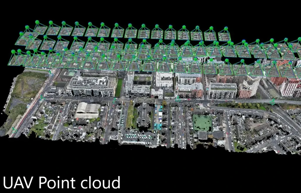
Point clouds generated from UAV Survey (Drone Survey Mapping) imagery are highly effective for extracting hard detail. This image-based reconstruction excels on exposed rock, concrete infrastructure, and areas with minimal vegetation.
The Advantages:
- Ideal for dense detail extraction on hard surfaces.
- Excellent for generating 3D models using nadir and oblique imagery.
The Limitations:
- Heavy vegetation breaks this computational model, making ground classification difficult.
- Automated photogrammetry can struggle to match imagery on uniform surfaces, creating warping in the final 3D elevation model.
Method 2: UAV LiDAR for Vegetated Site Surveys
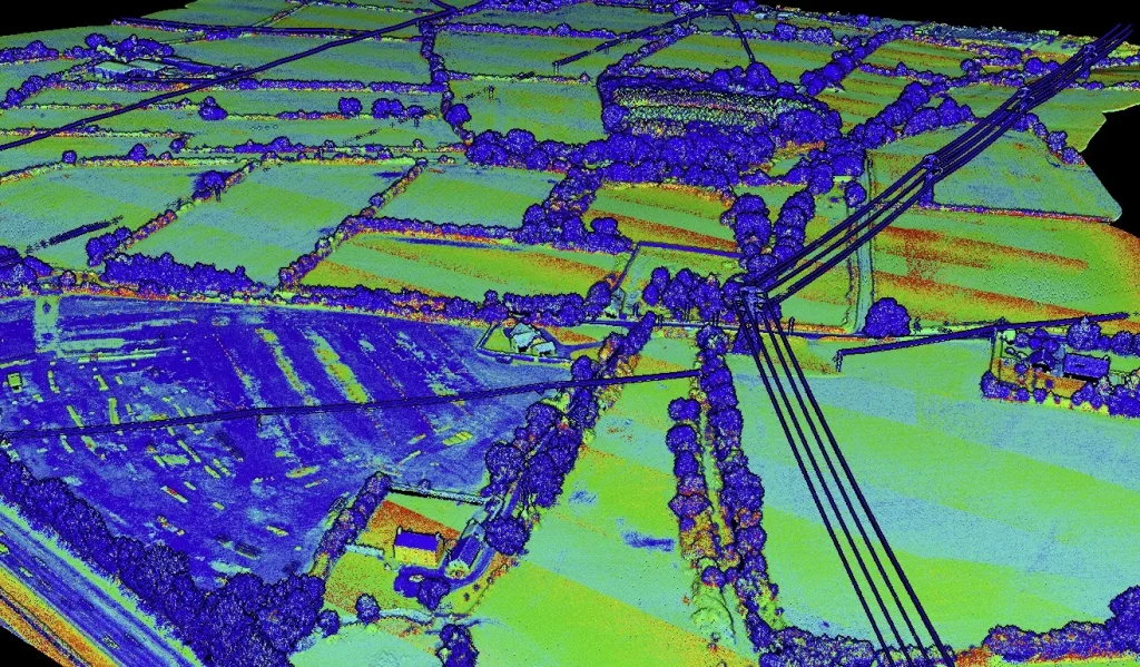
For vegetated areas, integrating laser scanning from an aerial platform is the superior choice. UAV LiDAR provides multiple returns. This allows the laser signals to penetrate the canopy and capture the true ground level beneath.
Modern systems also capture high-resolution imagery simultaneously to generate accurate orthophotos.
The Advantages:
- Drastically improved ground modelling in vegetated or overgrown areas.
- Combined LiDAR and orthophoto datasets provide a highly reliable terrain representation for an aerial site survey.
The Limitations:
- Extremely dense forestry may still limit the number of ground returns achieved.
- Small linear features, such as overhead wires or thin poles, can be difficult for the laser to detect reliably.
Method 3: Analytical Stereo Photogrammetry for Complex Terrain
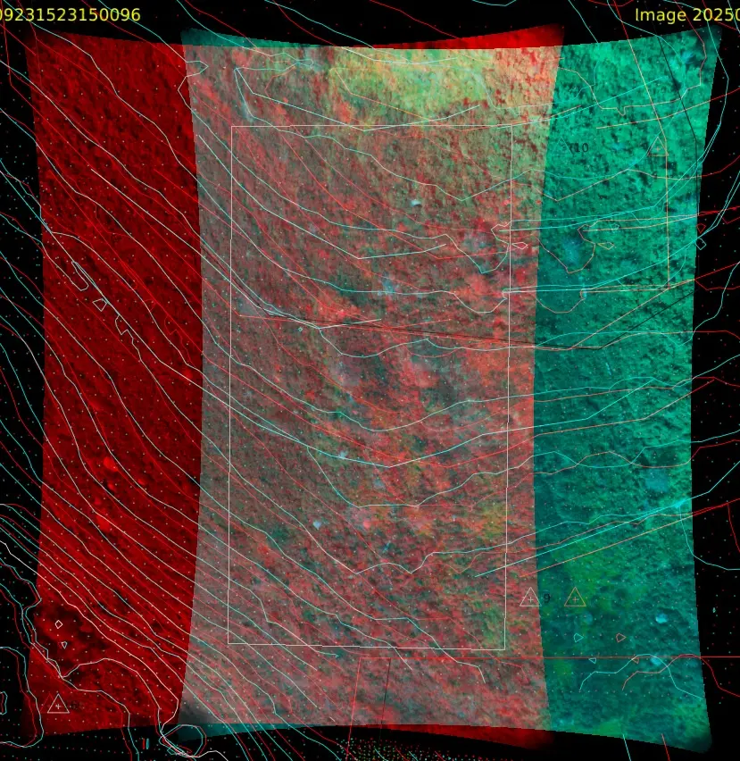
Analytical stereo photogrammetry has been used in land mapping for decades. This traditional approach creates stereo models that are viewed in true 3D. It allows an experienced land surveyor to manually extract data in complex environments where automated algorithms fail.
The Advantages:
- Human interpretation of subtle topographical features remains unmatched by software.
- Delivers highly accurate modelling in environments where automated methods struggle to define the terrain.
The Limitations:
- Requires highly experienced operators with strong stereo interpretation skills.
- It is a more manual and time-intensive process compared to automated point cloud workflows.
While more time-intensive, it provides excellent all-round accuracy for demanding elevation surveys.
Translating Aerial Data into Engineering Deliverables
An aerial mapping flight is useless if the data cannot be integrated seamlessly into the client’s design software. Complex infrastructure projects rarely rely on a single data capture method.
A robust survey combines ground-based GNSS control with appropriate UAV data to ensure absolute spatial accuracy. This hybrid approach guarantees a clash-free CAD or BIM deliverable for the engineering team.
Experience Over Technology
Technology matters. Experience matters more. Project managers must evaluate their land surveying partners based on their ability to interpret terrain, not just their ability to fly a drone.
Eliminate design risk before construction begins.
Contact iO Geomatics to specify the correct aerial methodology for your next project.
Aerial Methodology FAQs
What is the best drone survey method for land mapping?
There is no single best method. The correct choice depends on the terrain. Photogrammetry is excellent for hard surfaces and exposed rock. UAV LiDAR is required to penetrate vegetation and map the true ground level. Analytical stereo photogrammetry is necessary for complex terrain requiring human interpretation.
How does UAV LiDAR compare to photogrammetry for a land survey?
Photogrammetry uses overlapping photographs to reconstruct a 3D surface. It is highly accurate on hard surfaces, but cannot see through vegetation. UAV LiDAR uses active laser pulses that can penetrate gaps in a forest canopy to map the ground beneath. LiDAR is essential for generating accurate topographical data in overgrown areas.
Why do aerial site surveys require experienced land surveyors?
Automated drone software frequently misinterprets site features. It can mistake dense grass for solid ground or warp uniform surfaces. An experienced chartered surveyor applies engineering judgement to verify the data, ensuring the final output meets strict vertical tolerances (+10mm) for civil design.
Can aerial surveys completely replace ground-based surveying?
No. While UAV surveys can cover large areas rapidly, they must always be tied to physical ground control points established by static GNSS or total stations. Complex projects often require a hybrid approach, combining aerial broad-scale data with ground-based mobile mapping for critical, high-accuracy infrastructure.


