

Topographical Surveys Across Dublin

Professional Topographical Surveys Dublin | Expert Land Surveyors

We deploy advanced surveying technology such as mobile mapping, UAV and laser scanning in combination with conventional land surveying methods to deliver accurate geospatial data.

We can capture both an external topographical survey and a measured building survey in one seamless deployment.

A single, fully integrated survey solution. No coordination headaches, no unnecessary disruption, and reduced design risk

Secure a comprehensive geospatial data foundation to guarantee zero rework and protect your project budget.

The Commercial Risks of Outdated or Incomplete Data

  • Urban traffic and restricted access can limit efficient data capture on complex sites.

  • If site information is incomplete or out of date, it increases the likelihood of design revisions, coordination challenges, and added cost during delivery.

The Hybrid Data Advantage

  • We combine advanced survey technologies, UAV, Mobile Mapping, and laser scanning, with proven ground-based methods to deliver accurate, reliable site data.

  • Our approach is flexible: the right tools are deployed where they add value, ensuring efficient data capture without unnecessary disruption.

  • This provides a robust project baseline, supporting coordinated design and reducing the risk of delays or rework during construction.

Dublin Based Topographical Surveys

Overcoming Urban Challenges With A Precision Dublin Site Survey

Traditional survey methods are reliable but can be time-intensive on complex urban sites.
We combine precision with efficiency, delivering accurate data faster to keep projects moving.

Comprehensive Land Surveys Dublin: Inside and Out

Architects and project managers need a seamless transition from external site data to internal building information.

We deliver a combined survey service, capturing the full external terrain survey and interna/external measured building survey, providing a single, reliable baseline for design.

Our Approach to Topographic Surveys in Dublin

Site Mapping & Terrain Capture

  • The Focus: The external site environment.
  • The Service: We capture accurate data for site boundaries, surrounding streets, and visible utilities. Using the most appropriate methods for each project. From conventional techniques to mobile mapping, we deliver a consistent and reliable dataset for design.

Measured Building Surveys

  • The Focus: The buildings on or around the site.
  • The Service: We carry out high-accuracy surveys of building interiors across Dublin’s commercial and heritage sectors. Using advanced 3D laser scanning, we capture detailed floor plans, elevations, and complex structural features with minimal disruption to occupants.
Ireland UAV Topography icon

UAV Aerial Mapping (UAV Surveys)

  • The Focus: The aerial perspective.
  • The Service: For commercial developments or sites with restricted access, our drone teams provide rapid, high-resolution aerial point clouds. This complements the ground-level site survey and measured building survey, ensuring roofs and upper elevations are mapped with complete accuracy.

Revit Modelling and AutoCAD Drawings

  • The Focus: Integrated 2D and 3D survey deliverables.
  • The Service: We process survey data into both structured 3D Revit models and clear 2D/3D AutoCAD drawings. External terrain surveys and internal building data are combined into a single, coordinated dataset.


This provides your design team with flexible outputs, detailed drawings for immediate use, alongside a 3D model to support ongoing design development.

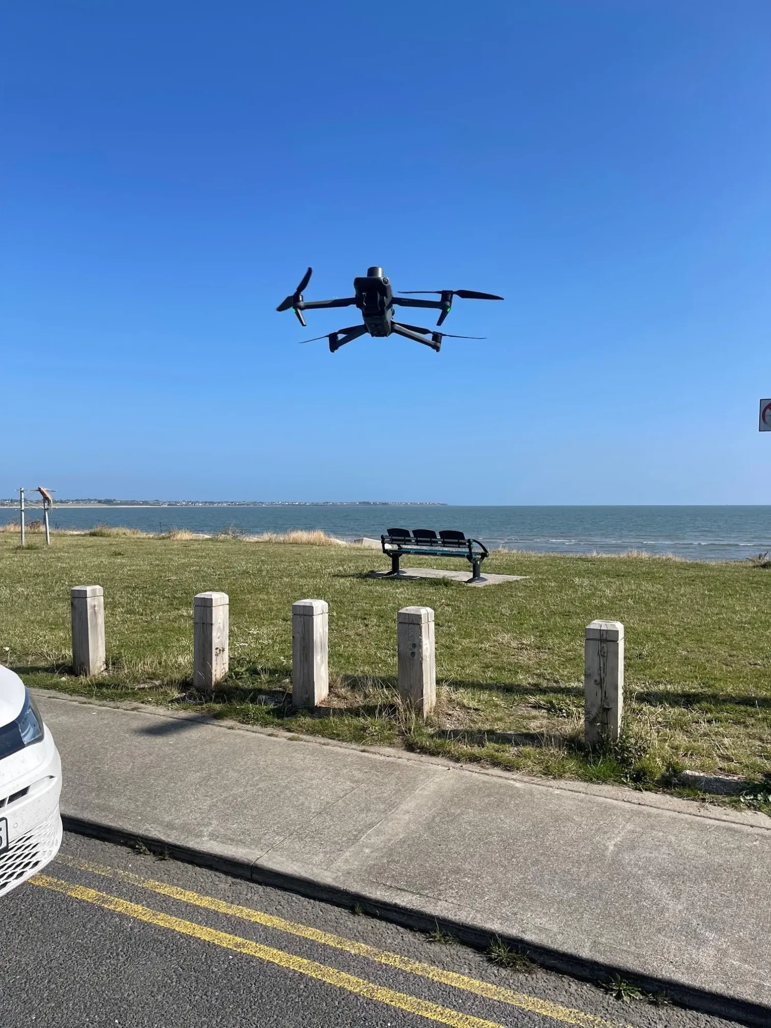
UAV Drone used for Topographical Survey Project in Dublin

Donabate Transport Scheme - Dublin Case Study

Featured Project: Donabate Transport Scheme (R132 Corridor)

  • The Logistical Challenge: Surveying 4km of busy national road networks alongside 7km of complex watercourses without causing traffic disruption or project delays.
  • The Rapid Solution: We integrated high-speed mobile mapping for the road corridor with UAV aerial mapping and conventional hydrographic surveying. This ensured complete coverage of diverse terrain within a strict 3.5-month programme.
  • The Commercial Deliverable: We delivered design-ready CAD datasets, a full 3D topographical model, and OPW-compliant cross-sections. This guaranteed spatial certainty for subsequent flood modelling and detailed infrastructure design.

Topographical Survey in Dublin

Recent Topographical Survey Project in Dublin

iO Geomatics has delivered critical spatial data for complex infrastructure across the capital for over 27 years.

We understand the specific logistical hurdles of operating in highly congested urban environments. 

By partnering with a specialist land surveyor, you mitigate all data-related risks.

The number one

Rigorous Scoping & RAMS:

We review the client’s specification and project requirements at tender stage.

Once appointed, we prepare project-specific RAMS and ensure all health and safety procedures, certifications, and documentation are in place prior to site work.

The number two

Rapid Site Mobilisation:

Our team mobilises efficiently to site, selecting the most appropriate survey methods based on access, complexity, and programme requirements.

This allows us to capture accurate data while minimising disruption to traffic and site operations.

The number three

Comprehensive Data Capture:

We apply a combination of survey techniques, including laser scanning, mobile mapping, UAV, and conventional methods, to capture terrain, complex boundaries, and visible features.

Utility information is recorded where accessible or provided, ensuring a coordinated dataset for design.

The number four

Final QA & Deliverables:

As a chartered surveying practice, we apply a structured quality assurance process to all survey data.

Our team of surveyors are all third-level qualified in land surveying, and we deliver coordinated AutoCAD and Revit outputs ready for design use.

The iO Geomatics Way

Our Streamlined Land Surveying Workflow

We have refined our operations to deliver high-quality, survey-grade data rapidly.

Our systematic process guarantees absolute accuracy from the first consultation to the final CAD handover.

Secure Your Project Baseline Today
With a Precision Land Survey

Move away from outdated or incomplete data and establish a reliable project baseline with verified spatial information.

Send us your specification or project brief, and we’ll review it and provide a clear, competitive quotation.

While our team is dedicated to Dublin projects, iO Geomatics also provides national coverage.
Learn more about our nationwide Topographical Survey services.

Topographic Surveys Dublin FAQs

Frequently Asked Questions:
Topographical Surveys Dublin

Here are some frequently asked questions for Topographical Surveys in Dublin.

Pricing depends on site scale, access restrictions, and the required level of detail. By deploying advance surveying technology, we drastically reduce time on site. This significantly lowers your overall project cost compared to traditional manual methods.

Survey duration depends on site size, complexity, and access constraints.

Smaller commercial sites are often completed within a day, while larger or more complex projects may require several days of site work. We use advanced surveying technology to minimise the time required on site.

We deliver survey outputs in the formats your design team needs, primarily AutoCAD drawings and Revit models. Point cloud data can also be provided where required or where the client has the capability to utilise it.

Based in North County Dublin, we can mobilise quickly to sites across the region and typically commence work within a few days of project confirmation.